Saturday, June 27, 2015

Lincoln to forest service road 1840A

Thanks to Frodo we were able to make it out of town at a decent time. I managed to mail my snow gear home since we heard that snow was no longer an issue. I'm glad I had it but I can't say I'm sorry it's gone. I'm now 2 pounds lighter and won't be getting scratched up by the ice axe anymore.

The hike up was difficult for me. I had the worst coughing fit yet on the trail getting back up on the divide. I forgot to take my allergy pills and had to use the inhaler to stop the coughing. Still it's better than the PCT because I have the pills and inhaler for just such occasions. I'd prefer not to use the inhaler but I'm not bailing on this trail like the PCT for the cough.

The hike was as amazing as ever hiking along these beautiful mountain peaks and valleys. We ended up camping at a water source which is getting rare again because we are up on the divide. It's not like the desert but we are doing 10+ mile carries again instead of the 2ish miles between sources we have experienced up here till now.

Near Caribou peak to Lincoln

Today was a fairly easy day. We are now up on the divide instead of down in the valleys next to it so we have fantastic views in all directions. That also means we are hiking up and down all day long along the ridges of the mountains that make up the divide.

Nomnom and guy on a buffalo, who road there shuttle with us and camped with us the last couple nights, have been in touch with Frodo who is going to meet us at Rodgers pass and drive us down to Lincoln to grab a bite to eat then we plan on heading back up to the trail to continue our hike. Yeah right. We got down in Lincoln had some food, drink and run into another group of hikers and we are staying in town. Which was cool cause nomnom and beads had had birthdays while we were in the wilderness so they needed a proper celebration. It doesn't help me make up time to get back to work on schedule but I should still be done by mid September.

Welcome Creek to near Caribou peak

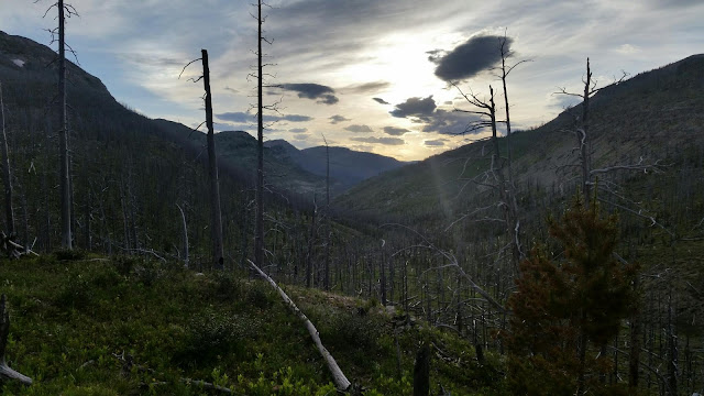
Another beautiful day where we ran into the folks we dropped off in Butte and had some amazing echoes. When I get an alp horn I'm coming back to hike this trail again. But 6k for a carbon fiber horn and lessons isn't in my current budget. Anyway I'm way behind on my journal so I'm just going to post pictures and write the next one. Btw we had one of our best camp sites ever for sunsets and sunrises. It's great to be up on the divide for the longest days of the year. The sunsets go on forever 

South Fork Sun River Bridge to Welcome Creek

We had a 5 mile hike to get to the benchmark ranch turnoff. Benchmark is a neat little staging point for people headed into the Bob. The ranch is basically the only spot to resupply from Glacier until Lincoln. They pick up boxes from the town of Agusta 30 miles away and store them in a lockbox in their porch. The ranch is a nice little setup with some rustic cabins. We ate all our extra food and took a nice 4 hour break before hiking on.

We excited the Bob without seeing any wildlife except a pack of elk and a few deer. I was disappointed, I thought the largest wilderness in the 48 states would have more wildlife. Either way it was gorgeous, just like the rest of today's hike. We ended up camping on a hill overlooking a stream valley with a rock of Gibraltar lookalike looming above us. It was a good day. I'm really enjoying hiking with Beads and Papichulo. They are out here to have fun hiking the trail, like me rather than hiking the trail to get it done or just having fun with  hiking as an after thought.

Mosquito lake to My lake

The hike up the pass in the morning was not a problem. The snow that was present already had steps kicked in and none of it was dangerous enough to take my ice axe out for. I did use my micro spikes because they just make walking on snow nicer.

It was another beautiful day and we got another tip from more rangers about our route. For having only 5 crew for each ranger district we have been running into them a lot. This time they suggested a camp spot called My lake. We'd have to go up an extra pass today but they said there was no snow and it was the best camping in the area. We mostly stayed low in the valley so we didn't get many views but the forest was very nice. The odd part was we saw no animals. A chipmunk or squirrel but that was it. We did see a lot of stream crossings and I even got up close and personal with one when I slipped crossing it. A wet shirt and pant leg but no harm done. It was actually nice since it was pretty warm out.

The lake we camped at was very nice. The ranger had warned us that it was full of leeches and he wasn't kidding. Just looking in while I got water I saw 10 and one started swimming toward my bottle. There was also a couple really curious deer up there. They had no fear of us at all, sleeping bags were another story. One of the hikers had left his bag out to dry and when it ruffled the deer took off.

South Badger creek to Mosquito lake

Another beautiful day. We got moving by 630 and were back on the official CDT by 10. It was a little boggy but the trail was easy. At the CDT we ran into another ranger and he suggested we take the spotted bear alternate since the main CDT was a big burned section.

It was also time for us to enter The Bob (marshallwilderness). There were all kinds of rumors about The Bob, the problem grizzlies from all over the country were dropped off there, the place was so wild it was like jurassic park, Bob Marshall still lived there as a wild mountain man with his family. Turns out most of that was false. It is the biggest wilderness area outside Alaska but they don't take problem grizzlies there since there is no way to get them there. It's actually one of the least dense populations of grizzlies in the region. The trail was in better shape than the back country of Glacier, but the wolf tracks are huge. I haven't seen Marshall yet but I'd like to shake his hands if I do. What The Bob is, is beautiful. Everywhere I look is another amazing sight.

We hiked until 9 pm to get halfway up a pass. We aren't expecting bad snow but since I'm the only one still carrying my snow gear I wanted to do the pass earlier when is safer. We ended up camping in a dry lake which only had two little puddles in them. Turns out all the mosquitoes in the lake were now concentrated in those two puddles. It was really fun messing with them.

Summit Mtn Lodge to south badger creek trail

We slept in till 7 since breakfast wasn't  served until 730. Compared to last night's dinner breakfast was disappointing, not bad but it was just a standard continental breakfast. Over all the dinner was great and worth it but they need to figure out the lodge. 150 to stay in a nice cabin with no modern convinces is fine, but a train rolling by every 30 minutes ruins the atmosphere.

The hike started out in a burn area with blow downs all over the place and rolling hills. In other words it was slow going. We eventually made it to a forest rangers back country cabin and they suggested an alternate route for the afternoon's hike. The CDT follows does a big pointless climb up a mountain that almost nobody ever takes. We opted out since it was through more burnt area. The alternate everyone takes is along the north fork of the badger creek. The rangers said this would be pretty muddy, boggy, and overgrown. They suggested we take the south fork instead which had less mud and bogs. I don't know how bad the north fork was but the route we took was pretty nice. Lots of views, medows, and trees. There were a few boggy sections but not really worth mentioning. Over all I'm happy with the ranger's suggestion.

East Glacier to Summit Mtn Lodge

It took me until noon to get out of town. I wanted to get the maps from Glacier to Helena on my phone before I started. I tried downloading them last night but the WiFi at the hotel kept cutting out and I was using my roaming minutes. I had a gig of maps to download and I think that's too much for a roaming connection. So I sat around at the local bakery this morning for two hours while they downloaded.

The hike was fairly easy. It was rolling hills on nice trail, I was back in Glacier for this section. Eventually some thunderstorms rolled in to make the hike more interesting. I couldn't see the lightning but the thunder was amazing.

I kept hiking to Marias pass where I was told there was a place to get dinner. I was completely surprised by the restaurant. They were a steakhouse that had just opened up for the year 2 days ago and this was their second year of operation. Their best dish, which 3 of us got, was a pork loin with a huckleberry glaze. It was delecious. I was joined for dinner by Beads and Papichulo who had ridden the van up and Wanderer the first true southbounder. After dinner, and some wine, we decided to rent one of the cabins since the owner liked us and was giving us a discount.

Wednesday, June 24, 2015

My lake to South Fork Sun River Bridge


So today is the longest day of the year. Along with that comes a tradition known as hike naked day. Beads and Papichulo were very Gung-ho and got some pictures next to the Chinese wall. I stayed clothed hoping I could try the other tradition known as giant bonfire day. The hike was fantastic. The wall was huge and totally worth the hike out to it. 

We hiked slowly taking lots of breaks and just enjoying our last day in the Bob. The weather was perfect and we took lunch at the end of the wall. Surprisingly there were quite a few hikers out going the other direction. This was the first time I'd seen anyone, besides CDT hikers, on trail outside of Glacier. I guess the wall is pretty popular or it's the first day of summer and people want to get out. 

We hiked until 9 before camping at a beautiful bridge near a river. I guess with all the horse packers they need a bridge to keep the river banks decent. I wasn't able to build a bonfire so I had to quickly hike naked across the bridge to keep my trail karma up. 

Wednesday, June 17, 2015

Southbound day 6

Another day another 10 miles another dinner with a huge group if hikers. Unlike the last three days today was perfectly clear. The hike up the pass was easy and the views were spectacular.

I had heard from the Rangers that the trail in the Blackfeet Indian side of the park was a muddy nasty mess. It wasn't that bad it was actually better than most of the trails in new Mexico. Granted compared to the near perfect trails of Glacier it was bad but so is pretty much every trail I've ever hiked. They take really good care if the trails in glacier.

Once in town we tried to get a room at the same motel we stayed at last time but they raised their rates by 30 a night. They said we are now in prime season and wouldn't give us, repeat business a break. We went to the motel next door that hadn't raised their rates, who managed to sell all their rooms for the night while the first motel had empties. We had made arrangements with the other hikers to meet at the local Mexican restaurant for dinner. We were joined by the guys who had hiked in the pervious day and another car full of flip flopers. We took over the entire back porch of the restaurant. It was almost as crazy as pie town.

Southbound day 5

The hike up to the pass wasn't bad at all. The snow field we had to cross was the nice hard compact stuff that doesn't post hole. I hiked at least a mile and a half on it without postholing once. The final stretch up to the pass has two snow chutes we had to traverse, both went straight down into icy lakes. But the snow was good and the folks that had already crossed it had kicked good steps in. I didn't need my snow gear but was using it anyway since I'm carrying the heavy stuff.

The pass was cloud covered again which was a shame. I had hiked this pass last year and the view was fantastic. The rest of the hike was a very easy cruise into the campground.

The campground was surprisingly crowded for this time of year. We had a reserved spot set aside for hikers but the rest of the 80+ spots were mostly full. Our spot was very full. We ended up having 12 hikers show up all but one flipping from new Mexico. We picked up some locals and car campers and had over 20 people having a good time around our campfire. Normally I would be bothered by people staying up past midnight but with another 10 mile hike scheduled for tomorrow it didn't really matter.

Southbound day 4

If yesterday was a short hike today was even easier. We had a 10 mile hike today. I was up and hiking early after the easy day yesterday. The only challenging part of today was going up over triple divide pass. Unfortunately we were completely covered by the clouds. When I got to the pass I couldn't even see the third divide which was 50 yards away. It was also cold and the could was filled with ice crystals. Being in an ice fog was kinda neat but we hurried off the pass.

On my way up the pass I saw my first grizzly bear. A cute little guy about 250 pounds maybe 50 yards away munching on some green shrubs. I have it a hey bear and it looked up at me with a mouth full of green stuff and it jogged off over the ridge before I could get a picture or axle could see it. On the other side of the pass I saw a moose. It was at the bottom of the valley and was just a brown spec. I'm not sure if it was a moose because if the distance or not but it was the right size and vaguely the right shape so I'm calling it a moose. It was way to far for a picture though.

When I finished the 10 miles by noon I was seriously considering hiking on. It was only 15 more miles to two medicine which had a front side campground so I didn't need a permit. But we had met some hikers coming down the triple divide pass that said there was two miles of snow approaching the pass. Good easy snow but snow. I'm still not confident in the timing it takes to hike snow after Colorado and didn't want to get bogged down in it with 12 miles to hike so I stopped for the day. The fire we built while eating lunch and large group of hikers definitely helped make the decision.

Southbound day 2

I'll let the pictures talk for me today.