Friday, May 15, 2015

Bonita canyon to grants

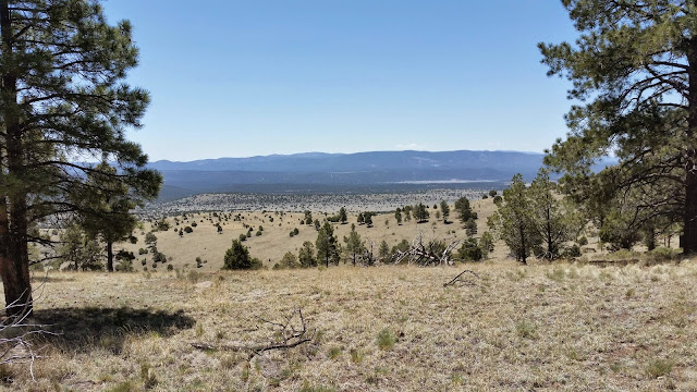
I had 20 miles to get to town so i got up early and was hiking by 615. My best yet. The first 8 miles was in a nice wide open grassy canyon which deserved the name Bonita after that lava field. The hiking was easy with great views of of the surrounding Mesas. The day was cool and overcast so I made great time. I got to the turn to Zuni canyon by 9 am. That meant I'd hit my first 10 by 10 of the trip. If I kept it up I'd have a 20 by 2 and be in town. That's the pace I'd need to do to get 30+ miles in a day. My shin started to get sore after 15 miles but with town calling I just hiked on. Even though I was going fast another hiker caught me and we did the last bit into town by 130. It felt good to hike like that after being slow and crippled for so long.

Zuni canyon was even prettier than Bonita in it's own way. I was walking between two big Mesas worth some great coloring. It was just like the Gila but with a gravel road instead of a river.

On the way to the hotel in town there was a guy selling beef jerky and needing to resupply I stopped by to grab some. It was unlike any I'd had before. It seems the locals around here prefer their jerky to be completely dried out until it become hard like a chip. I wasn't a fan but he had some great flavors. He also had a few flavors done in a style closer to what I'm familiar with and I got 2 bags of it since it was way better than anything a store has. Much leaner with almost no salt and nicer thin slices.

Hwy 117 to Bonita canyon

Today's hike is the reward for yesterday's road walking. There is still a lot of road walk but there is even more trail and views.

The day started with a 5 mile asphalt road walk to a Mesa. There is supposed to be a trail up the Mesa but we got off the road a little to early and bush whacked our way up. We found the trail up at the rim of the Mesa. It was cool. There was a big drop to a lava field that stretched for miles to our west. We had such a great view. At the end of the trail was a lookout to a nice big arch. What made this trail more interesting is there is no trail down. It's supposed to be an out and back type thing. But that's not something thru hikers do so we just found a non sheer cliff and went down it Maine style.

At the bottom we grabbed lunch then hiked another few miles on the road to a trailhead. The trailhead is where the official CDT comes out to hike into grants. I didn't want to do another 20 miles on asphalt and Ley had an alternate through two valleys but I had to hike an extra 10 miles. Giggles decided he wanted to get to town and took the road.

The trail went across a lava field for 7 miles. Luckily my shin splints were feeling really good or that would have been a difficult hike with all the uneven footing. The lava was just like hiking in Hawaii. It was a bit disturbing coming across some huge crevasses but anytime it was more than a step across the forest service had built a rock bridge of sorts.

The lava hike slowed me down and I didn't get out of it till 7 pm. I still had 3 miles to hike to get to water, and even though I had enough for a dry camp I wanted to get there so I didn't have to deal with it in the morning. I wanted to get an early start tomorrow so I had time to enjoy town and not just run chores. I made it right around 815 which gave me 20 minutes before dark to get setup and filter the water.

Thomas ranch to hwy 117

I had a good rest last night. Having a bed definitely helps. Today's hike is going to be pretty boring. Almost 25 miles of road walk with not much water. Giggles, another hiker that stayed at the Thomas ranch hiked with me. It was nice having company for the long walk. I could tell he was getting a bit frustrated with my slow pace by the end of the day. We made it to the windmill by highway 117 and camped.

Pie town to Thomas ranch

The post office opened at 800 but they ask that we don't show up until 9 so they can get the locals p.o. mail delivered. I grabbed my boxes and filled my food bag then headed over to the restaurant for brunch. After a burger and pie I headed out of town.

The hike today was all road walk. It was 15 miles to some locals ranch who will let us fill up on water. The hike was pretty boring and uneventful. Not much to look at other than one cool mountain til the easy.

The ranch was nice. It was an old retired couple that had bought it a few years ago for cheap. They gave us water and we hung out and talked with them. I decided to camp here since the camping is difficult ahead since we are on a road and there are private ranches along it.

Sunday, May 10, 2015

Pie town zero

I have to wait until Monday for the post office to be open. So I'm now taking my 11th zero.

Pie Town is a cute little place. It has 2 pie shops and that's it. Normally the two pie shops aren't open in the same day, but since today was mother's day they were both open. This worked well for me since one was actual food and the other was amazing pie. I had pie at both places but the second was by far better pie.

I had a New Mexico pie at the first place which was good. It's what I had wanted to cook for the last chili cook off at work. A green chilli apple pie but couldn't get any green chilies. They also had pine nuts in the pie since those are another thing New Mexico is known for.

The rest of the day was very relaxed just hanging out chatting. Most of the hikers left in the morning only those that are waiting or healing are still here.

374 to pie town

There was 32 miles to pie town. But only 20 to the highway. My plan was to do the 20 miles to the highway then try hitch to pie town. If I didn't get a hitch I'd camp by the road and walk in in the morning. The issue was water. The water was 10 miles from the road and 22 miles from town. I decided to get up early so I could try make the 5 miles to water while it was cold. Then get as close to the road as I could while it was still cool. That way I'd use less water.

I got moving by 630 and made it to the first water easily. I grabbed 4 liters since I wasn't sure how well the next water source was. It took forever since my filter was clogged.

As I was heading to the next water 1.5 miles away I stopped to grab a snack out of my pack. When I looked back the direction I came and saw this big angry cloud. It was definitely a rain could so I quickly dug my rain jacket out of the bottom of my pack and threw my pack cover on the pack. Just as I'm synching the cover down the first flake came down. Not rain snow. It didn't snow for long but it was coming hard. I was OK with it since it was cool which meant I'd need less water.

The snow let up and I made another 5 miles just in time for it to hail. It was slightly bigger than pea sized but started to come down hard enough to sting. I considered hiding under a tree to wait out the storm but I could see sunny blue skies in just a half mile. I out hiked the storm. It was just channeled through the mountains so once I got out of them the wind was blowing the clouds away from me. The nice part about the weather was how little water I was drinking. The rough part was trying to keep warm without sweating or freezing. 

After that the next few miles was hiking through a forest which made keeping a comfortable temperature. When I was in the shade it was freezing, in the sun I was melting, in the wind it was even cooler. I was wearing my windbreakers, long sleeved shirt and shorts. By opening and closing my windbreaker I was able to stay almost comfortable. But not really it was cold. 

Upon leaving the forest I was in a wide open plain. There was nothing for 7.5 miles. The wind was intense. About as bad as the hike into lordsburg but colder. Luckily it was mostly at my back. 

When I made it to the road it was 3 pm. If I got a lucky hitch I could make it to pie town and still get pie. I sat down and started to hitch. After an hour I couldn't make pie anymore so I started to walk to town. There was also the storm starting to creep toward me so I was going to get snowed on again if I stayed at the road. I walked for an hour making good time but I was tired. 25 miles is about all I'm comfortable with. After another 30 minutes I finally got a hitch. 

Pie town was crazy. There were so many hikers here. Almost nobody hiked out due to the weather and a lot of us did extra miles to get out of the weather. It was nice having people around but it was overwhelming after such a tiring day. Even still it was nice there was a big communal dinner of potato salad, spaghetti with elk meat marinara sauce, and some elk steak bites. After that one of the locals brought over her instrument collection and there was an impromptu jam session which sounded half decent. 

Wagon tongue mtn. To mile 374

I woke up early to catch the sunrise and it was great. I've seen better in NM but none of those had scenery to compare. Since I was already up I just started hiking. The miles flew by. It helps that it was all down hill or on brand new trail. You could tell it was brand new cause it just ended and you had to follow stakes for a couple hundred feet. Guess they are still working on it. I made it to the next water source 7.5 miles away by 9 am.

I then lingered for 45 minutes trying to figure out what to do next. I have a package at the post office, I hope, in pie town but I won't get there until 5 pm Saturday at the earliest. The post office closes at 930 am. The only way I'd make it is if I did another 35 miles on top of the 7.5 I've already done. That means either I hike slower or I take another zero. As awesome as pie town sounds I'm sick of zeros. That gives me the option of continuing my planned route following Ley's road walk that takes me directly into town, or taking the official trail and hiking(or hitching) am extra 12 miles into town. Since I have time I want to do the official route, especially since they have added a lot of new trail in that section. The dilemma is my shin splints. I should get to town and take a zero to rest them. The 20+ miles I've been doing don't seem to be making them worse but they aren't healing either. I eventually decided to take the official trail due to water. The first 35 miles of the official trail has more water than the road walk. The road walk starts out with a 18 mile carry over a 9500 ft mountain. The second half of both routes are equally bad for water.

Having now hiked it if I were to do it again I'd do the first 11 miles or so on the trail. Fill up on water around mile 9 then take a road walk to the Ley route. That would let me enjoy the new trail, not have major water issues for the first 20 miles and still get to see the view from the lookout tower on the 9500 ft. mountain. Then have an easy road hike into town.

I was very pleased with my choice. The trail was just what my feet needed. It was this soft packed dirt with no rocks or anything. The obstacles, hills, and detours broke up the monotony of the road walk and caused me to use different muscles. The first few water sources were nice clean cow water. It was obvious that no cows had been using them. The last two sources were a different story. While there were no fresh evidence of cows both sources were nasty funky ponds. I had to take two liters from the last source for dinner and the hike to the next well. I double filtered it just to be safe.

Cox canyon to wagon tounge mtn

Another cold morning where the condensation in my tent froze. I of course got up late due to the cold. I got moving around 730 just after two other hikers passed me. They did 27 miles yesterday so no way will I keep up with them when I get wiped out after 23. I did run into them at lunch but probably won't see them till pie town.

The hike was a continuation of the road walk for the first 6 miles. The road changed to a packed dirt instead of gravel so it was much kinder to my feet. I was glad that I was hiking road since it was a long hike up a 9250 ft mountain. When I got to the top I met back up with the official CDT which was actually up on the continental divide. It was neat looking at the terrain and seeing the divide.

The next 6 miles was on trail and kept following the divide. That meant lots of ups and downs. I made a mistake when I planned my water for the day and didn't factor in the terrain. I was already going light on the water due to the 6 mile road walk and cool temperatures so I only had 2 liters for 12 miles. The first 6 miles went by smoothly. I finished with a liter and a quarter. The next six miles I made me drink that and take a detour to a cow pond to grab another liter. The first cow water I've had to drink. Ah well.

The next stretch was a Ley shortcut, Ley is the guy that put together the physical maps I'm carrying that have nice detours and useful notes. This detour took me down a canyon which reportedly had a good natural water source. It was perfect. Ice cold, crystal clear and just plain delicious. I happily dumped the cow water I was carrying and drank like a sailor on shore leave. I knew I wouldn't make the next water source in 10 miles so I grabbed an extra liter for dinner and went on my way.

When I rejoined the trail it sent me straight up an 8800 ft. mountain. On the back side just for giggles I turned my phone on and had roaming reception. Thanks Verizon for letting sprint roam. I got a hold of Bill, my friend sending my resupply boxes, back home and asked him to send an express delivery with a spare socks and my extra sport shield. I have already blown through one pair of my toe socks and my darn toughs gave me blisters yesterday. So I was forced to wear my sacred sleeping socks, which aren't great for hiking since they have very low ankles. But they don't give me blisters so. The darn toughs are for cold days not every day hiking. They are too hot for that.  The sport shield is basically lube to prevent rash. I am now in my third bottle of it having left one at home, left one in silver city, and now the new one.

After getting that arranged I started hiking down the mountain to try get 4 more miles in, that way I could keep averaging 21 miles a day and get to pie town Saturday before the pie shops close. That didn't happen. I found this prefect camp spot with a 250° view. I knew right away there would be an amazing sunset and sunrise and there was no way I'd be hiking past this.

There are two hard rules hikers live by, hike your own hike, and smiles before miles. Camping on this ledge is how I fulfill those rules. I've had trail friends in the past say I do too many miles and not enough smiles. Sure hanging out with other hikers is fun. A zero or nero is great once in a while. Meeting townies and getting to know the local culture is interesting. But camps like this are why I'm out here. These are how I get my smiles more than those other experiences and this is how I hike my hike.

Snow lake to cox canyon

I lingered in camp and didn't get moving till 745. I was still tired from yesterday but I have 20 miles to the next good water. On top of that I need to average 21 miles a day to stay on schedule. So I reluctantly started hiking. With the reception of a 2 mile cross country hike all day today is on road. That means quick miles, in theory at least. Turns out quick miles are a no go with my ankle. Any time I tried going more than 2.5 mph it would start hurting. It wasn't noticeable if I just hiked slower.

Other than the cross country section which sent me up a canyon the day was pretty uneventful. Around noon I got really sleepy but couldn't find a good spot for a siesta. Towards the afternoon my feet stated to hurt from all the gravel. I also got a blister due to having a different walking style with the shin splints.

I eventually called it an early day at 530 having already covered my 21 miles. I was worn out and the water in the canyon started to dry up. I didn't feel like dealing with filtering water as tired as I was so I just setup camp and gonna get to bed early.

Unfortunately my dinner turned out poorly. I tried making my own rice dish using sushi rice, with chicken bouillon and lemon seasoning from home. When I tried it out at home it came out ok. A few bits of rice weren't fully cooked but it was tasty. Out here though, due to the temperature or altitude it didn't fully cook. The outside was good but the inside was crunchy. I was only able to eat half of it. Ah well I have at least 2 more of those so hopefully it comes out better next time.

High route

Felt good this morning, not counting my shin. My plan for the day was to take the high route and get away from the river to see if my shin splints felt better. I still had 1.5 miles to go to get to the trail junction and ended up crossing the river 7 more time for a total of 110.

The hike up to the high route was tough but easy at the same time. It was 800 ft in a mile but was switch backed and graded for pack animals. It took me about an hour but I made it to the top with some excellent views of the valley below.

The high route was amazing. One of the best trails I've hike in terms of scenery and difficulty. I was up on a Mesa and had almost no hills except to switch Mesas. The entire time I was in this great ponderosa pine forest which was both open and enclosed at the same time. Every once in a while there'd be a medow, a stream, or a view to keep the green tunnel effect at bay.

Once it got over the climb and the effects of the mornings river crossings my shin loosened up and stopped hurting. I definitely feel that once I'm done with the river my shin splints will start to go away.

With that in mind when I had to get down off the high route to switch to the other side of the river I decided to just hike the river. The guys I camped with last night had just reached the trail junction at the same time I did. Considering they are much faster than goes to show how much easier the high route was compared to the crossings. They had crossed the river 62 times in the 12.5 miles between when I left then and rejoined.

I decided since there was another 800+ ft climb and I wouldn't see a river again for a long time that I would hike the remaining 7.5 miles of river. I figured my shin wasn't going to get much worse and at the end of the river was a public camp ground. Since it was cinco de mayo I thought there might be some trail magic. There wasn't so we had to make do with the 3 margaritas I packed out. I wasn't going to make the same mistake as last year and not celebrate on the trail.

The hike to the camp was rough. The first  3 miles had been devastated by the flood and there was no path to speak of. It got better after that as there were pack trails established but by that point I was done. I wasn't sure if I'd make the remaining 4 miles. But the call of trail magic is strong. I pushed on and eventually made it to the campground where to no surprise there was no trail magic. If I'm ever not doing anything on may 5th I'm going to find hikers and give the margaritas and tacos. Truth be told even if there was trail magic I was too wiped out to enjoy it. According to both my step counters I had hiked a marathon, but I only did 22 actual miles.

On the trail again

So after spending as many days taking zeros as I have hiked I decided to hike out today. My shin felt great yesterday but it was sore when I got up this morning. Whatever it's had 9 days to heal so I'm going.

I had a long hard hitch to get back to where I left off. I got the first 30 miles real easy, it took 3 hitches but basically the first car that I thumbed at stopped. The last 14 miles didn't go as well. After hitching for an hour and half with only seeing 4 cars and 2 motorcycles I decided to just start walking. If I got a ride great, if not I'd just stay at the hot springs again. After a mile and a half and 4 water bottles discarded by the bikers a truck finally showed up and let me ride in the bed. He was going to right before the cliff dwellings for his job but offered to take me the extra mile. He also gave me a coke so the wait was totally worth it.

The cliff dwellings were neat, not on as steep a cliff as the ones in Utah but still every bit as interesting.

After grabbing lunch I finally started hiking again. I'm taking a short cut up a slot canyon to get back to the river. It'll save me about 6 miles of hiking and I get to go canyoneering... sorta. The canyon was fantastic nice steep walls but still plenty of space. Nothing technical in here. It was pretty unnerving though since there was a thunderstorm blowing through right as I get to the steep part with no way out but down. Luckily there was no flash flood, just a nice spring shower with lights and sound.

I'm no longer hiking the full Gila. It splits back around the cliff dwellings. What I'm hiking now it the middle fork. It is spectacular. I highly recommend it to everyone. It has all the features of the national parks in Utah, hoodoos, canyons with big walls, crazy colorful rock walls, arches, cliff dwellings and art, plus lots and lots and lots of river crossings. I'm now up to 103 total. 61 on the main river and 42 on the middle fork. According to my maps there is at least 84 more to go.

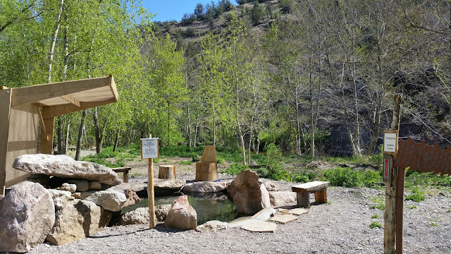
After about 10 miles I came to the Jordan hot springs. The map notes say these are the highlight of the Gila route. I have to agree. While not as hot as the ones by doc Campbells the scenery is second to none. When I was laid up in silver city I watched a show about a guy who makes crazy elaborate lagoons for people and this natural spring blew the things on that show away.

Right before the hot springs was a perfect natural amphitheater. I got the right as another thunderstorm was rolling through. It. Was. Amazing. The thunder would bounce and echo off the walls. So a small little rumble would last for a good 30 seconds and a big one was crazy loud and just kept going. I really wish I had bought an alp horn like I wanted to for this hike. This would have been the perfect spot to play it. I'm going to have to get one and come back here some day.

After soaking in the hot springs for a bit I decided to try and push 8 miles to a place called the medows. There is a trail junction there to another route that will take me away from the river. As much as I'm loving hiking the river my shin splints are not. They were ok until I started crossing. Once I started crossing they started hurting and felt like they did a week ago. I think all the uneven footing and the water itself is making them worse. There is an alternate route I can take that follows the ridge so no more river crossings that I can get to from the medows. It's longer but should be easier. Plus if I get there I won't have to do any cold morning river crossings. I was probably going to make it, I had 2.5 miles left at 7 and it gets dark around 8 but it's slow hiking with all the river crossings and lack of trail. We'll never find out cause I called it quits early when I ran into a group of hikers around 730. I decided to go with company to comiserate with me in the morning about the cold wet morning river crossings.

Saturday, May 2, 2015

Still in silver city

I was very close to hiking out today. I am feeling much better, but I'm still not healed enough. I got up planning to hike today and walked a mile to the local donut shop for breakfast. I didn't have any real pain and my muscle wasn't seizing up but there was still soreness as well as the old rubber band feeling.

The thing that worried me was the rubber band feeling. If it was just pain I'd have hiked. The rubber band feeling isn't normal. The issue I'm having is my muscle has felt basically the same for the last three days. There was less pain today and when I went to Walmart the other day the muscle slightly seized up. So its obviously better. But that was a more strenuous walk. The thing I'm questioning is if resting is doing anything for it anymore. The difference between two days ago and today wasn't really noticeable.

I could probably hiked without a problem, but then again I might not. Next is the longest stretch in new Mexico between resupply. I decided to take two more days off to see if the rubber band feeling will go away.

Really what it boiled down to is time. I have time. There is still snow in Colorado. Getting there sooner won't be a big advantage. Walking through snow is tiring and slow. The longer I take to get there means less snow. On the flip side is its getting hotter and dryer every day I sit around.

Monday, April 27, 2015

More zeros.

I'm back in silver city. I was moving around too much up at the hot springs. Add good as they were for my muscle the 6+ miles a day I was walking around up there isn't what I needed to get better. Plus this morning it felt slightly better and I was considering pushing on. If I had stayed up there I would have gone hiking too soon. I'll be in town for three days then I'll reevaluate.

Sunday, April 26, 2015

Another day another zero

Still just hanging out up at the hot springs. The ankle isn't any better. It's exactly like the injury in the AT so I don't see any reason to go to the doctor. They'll just say rest, ice, and anti inflammatory meds. They might give me better anti inflammatory drugs but that's it.
I'll probably head into silver city tomorrow if for no other reason than I will move around less in a hotel room.

Saturday, April 25, 2015

Doc Campbells

Shin splints were bad this morning. Decided to take a few days of up here. I thought about hitching back into silver city, but then I'd spend 200$ to sit around in a hotel room by myself. Instead I'm up here in by the river worth hot springs and a river to alternate cold hot and speed my healing. If it's still bad after the weekend I'll head to town and get it checked out.